






Vaishnavi Nandedkar
Introduction
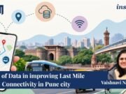
Metro networks are an essential part of urban transport planning but, a metro trip doesn’t merely start or end at the metro station. Commuters are usually required to take other forms of transport such as walking, buses, auto-rickshaws, cycling, among others to complete their trip.
This is why the last-mile connectivity becomes an important concept in transport planning. While a metro station may be connected to the entire city through the rail link, its accessibility would also depend on how easily one could access the station. This is especially true in Pune, where the metro exists together with a bus network, roads and sidewalks, among other forms of transport infrastructure.
Last-Mile Connectivity
The term ‘last-mile connectivity’ indicates the part of a trip made between the main public transportation system and the origin or destination point of a commuter. In the case of a metro passenger, it can be a trip from home to the station or from the station to the workplace.
Connectivity is usually measured in terms of distance. A bus station which is situated at a distance of 500 meters from a metro station seems to be accessible enough. But the walking distance might turn out to be more due to various reasons like roads, crossings, barriers, or even missing segments in the walking network.
The service frequency is also an important factor. Two metro stations having similar bus connections but with different connectivity depending on the available routes for those bus stops.
Thus, last-mile connectivity depends upon accessibility and connectivity of various means of transport.
Role of Data
Metro station distribution can be analyzed in conjunction with PMPML bus stop distribution and routes, and road and walking network data could offer information on the movement between them. The analysis of all this data could bring to light patterns which may not be evident if these different modes are looked at separately.
For instance, the amount of bus stops available near a metro station gives an idea about the connection possibilities, and routes available for those bus stops give the area of coverage of the bus network. Walking distance, in turn, could offer insight on how easy it is for commuters to access these connections.
This would allow asking more detailed questions such as how many connections are there, how far away from the metro station they are, how are they distributed and can commuters get to them?
Spatial Analysis
Since last mile connectivity is heavily dependent upon location, GIS can help in providing a better idea about the reality of the accessibility.
An area covered by buffer distance around a metro station gives an idea about the area covered by the station, but that doesn’t mean that it covers the actual distance which a person would travel walking from there. A point which might be 500m away from a station in straight line may be much further away considering the network around.
Network analysis would take into consideration the difference and give an idea about the route the commuters would use.
The analysis would also show the distribution of connections in and around the stations. There may be several bus stations within the vicinity of the station but mostly on one side only.
Measuring Accessibility
Data enables various dimensions of access to be taken into account. The presence of bus stops and their density can measure public transport access, whereas connecting routes can measure access to various destinations via the public transport system. Network-based walking distances can give a better measure of inter-modal transfers, while pedestrian network features can offer further insights into the context of the location.
These measures can help explain why there are differences in connectivity for stations. One station could have adequate bus access but poor pedestrian access, whereas another station could have well-connected pedestrian networks but poor public transport access.
Implications for Planning
What makes such information valuable is the fact that it will contribute to better planning. If there are bus services available, but accessing them through walking is hard, making improvements in pedestrian access might be a priority over increasing services. If pedestrian access is fine, but connections to buses are scarce, making connections might prove more beneficial.
This applies especially to Pune since the locations of metro stations are different and each urban environment has its own road structure and transport connectivity. Such information will help to understand the areas which need improvements.
Conclusion
“Last mile connectivity” is a term that is usually talked about in the context of adding more buses, feeds, or pedestrian systems. But it is also important to understand how connections already in place actually work.
By using data about the metro stations, bus routes, road network, and pedestrian routes, data can allow us to go beyond whether a station is “connected” and start asking how it is connected, how accessible the connection points are, and where there are still problems.
It is important to keep in mind that data will not enhance the last-mile connectivity on its own. The strength of data is that it provides a way of measuring an existing transportation system.
References
Centre for Development Studies and Action. (n.d.). Last mile mobility planning. https://cdsaindia.org/last_mile/
IMPRI. (n.d.). Last-mile connectivity in urban India.
Mahindra Lifespaces. (n.d.). Pune Metro last-mile connectivity: A real estate guide. https://www.mahindralifespaces.com/blog/pune-metro-last-mile-connectivity-real-estate guide/
Pune Metro Rail Project. (n.d.). Last mile connectivity. https://www.punemetrorail.org/last mile-connectivity
World Resources Institute India. (n.d.). Unlocking connectivity: Mass transit in India. https://wri-india.org/initiatives/unlocking-connectivity-mass-transit-india
About the Contributor: Vaishnavi Nandedkar is an architect and urban development professional. She is currently a Research and Editorial Intern at IMPRI, with an interest in urban development, sustainable planning, and the built environment.
Disclaimer: All views expressed in the article belong solely to the author and not necessarily to the organisation.
Read more at IMPRI:
Sustainable Mobility Vs Global Transitions
A Spatial Perspective on Unauthorised Colonies in Delhi.
Acknowledgement: This article was posted by Tanisha Hooda, a Research and Editorial Intern at IMPRI.