





Dr.Nidhi Chauhan
Road traffic crashes are often described on the basis of numbers, i.e., the number of
people killed, injured, the number of vehicles involved, or the number of crashes recorded.
But behind every number is a person, a family, and a community affected by a preventable
event.
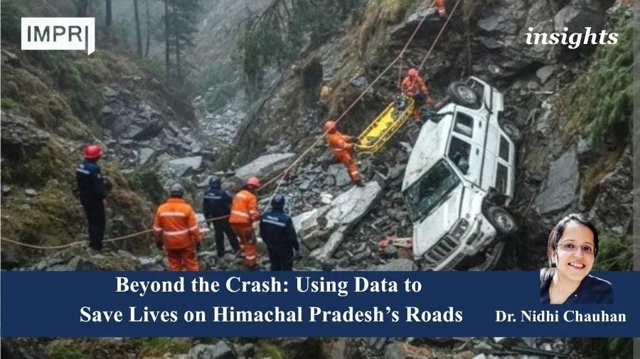
In a mountainous state such as Himachal Pradesh, known for its mountains, valleys,
and scenic roads, road safety presents a distinctive public-health challenge. Himachal
Pradesh’s mountainous geography presents a unique set of road-safety challenges. Roads
traverse steep slopes, narrow valleys, sharp curves, bridges, and landslide-prone terrain, often
under changing weather and environmental conditions, with long distances between
settlements and essential services. These geographical constraints interact with road
engineering, traffic and travel patterns, vehicle characteristics, human behaviour and
emergency response times, creating a complex risk environment in which conventional
approaches to road safety alone may not be sufficient.
Rather than asking only “Where did crashes occur?”, a data-driven road-safety
system should ask: Where, when, how and why are people dying—and where can preventive
action have the greatest impact?
This is where data can transform road-safety management.
From counting crashes to understanding risk Every year, a substantial amount of information is generated about road accidents through police records, transport systems, hospitals, and emergency medical services. Traditionally, these data have often been used in silos. A more integrated approach can provide a much clearer picture of road-safety risk.
Crash data can answer basic questions: Where and when are crashes occurring? Which
vehicles and road users are involved? How many people are killed or injured?
However, road-safety analytics should go further.
For an instance, a district with a high number of crashes may simply have greater traffic
exposure. Another district may have fewer crashes but a disproportionately high number of
fatalities. Similarly, a road section may not qualify as a conventional black spot but may
contain characteristics associated with future severe crashes. Therefore, the focus should
move from crash counting to risk identification.
The importance of spatial analysis in a mountainous state
Using Geographic Information System (GIS) tools, crash locations can be mapped against
road networks, elevation, slope, curves, junctions, bridges, settlements, schools, markets, and
healthcare facilities. Such analysis can identify clusters of crashes and fatalities and help
understand whether certain geographical or road characteristics are associated with severe
outcomes. GIS can also support emergency planning by showing the relationship between
crash locations, ambulance availability, hospitals and trauma-care facilities. This can help
answer an important question: How quickly can a seriously injured person move from the
crash site to appropriate medical care?
Moving beyond black spots
Black-spot identification remains an important road-safety intervention. However, relying
exclusively on historical crash concentrations can mean that action occurs only after repeated
crashes have already taken place. A complementary approach is to identify potential risk or
“grey” zones. These could be locations where combinations of road geometry, traffic
exposure, speed environment, visibility, vulnerable road-user activity, terrain, or other factors
indicate elevated risk, even when historical crash numbers remain relatively low. For a
mountainous state such as Himachal Pradesh, such proactive analysis could be particularly
valuable.
The objective is not to replace established black-spot methods but to complement them with a
preventive, data-driven approach.
Linking crash data with health data
A crash does not end when the police record is completed. For the health system, the
important questions continue: Was the injured person transported within golden hour? How
severe were the injuries? Was the patient referred? Did the person survive?
This highlights the value of linking crash data with emergency medical and hospital data.
Systems such as eDAR (electronic detailed accident report) can provide valuable information
about crash circumstances and casualties. When appropriately linked with hospital and
trauma-care information, these data can provide a more complete understanding of injury
outcomes.
Such linkage can help identify not only locations where crashes occur but also locations
where the health-system response may require strengthening.
Seeing the Risk Behind the Numbers
State-level fatality figures can mask important differences among road users. Disaggregating
data by road-user type, age, sex, vehicle, crash timing and injury severity can reveal patterns
of risk and identify groups or locations requiring targeted intervention. These insights can
guide engineering improvements, focused enforcement, pedestrian-safety measures,
ambulance positioning, referral pathways and trauma-care planning. Thus, an integrated data
ecosystem can help Himachal Pradesh move from reactive crash management to proactive,
evidence-based prevention.
Building a road-safety data ecosystem for Himachal Pradesh
The long-term opportunity for Himachal Pradesh is to develop an integrated road-safety data
ecosystem that brings together police and eDAR data on crash circumstances and casualties,
transport data on vehicles, drivers and enforcement, road and engineering data on
infrastructure and road characteristics, GIS data on geographical and spatial risk, emergency
medical service data on response and transport, hospital and trauma data on injury severity
and outcomes, and weather and environmental data on conditions that may influence crashes.
When these sources are responsibly integrated, road-safety authorities can move towards a
continuous cycle of:
Data → Analysis → Risk identification → Intervention → Evaluation
The way forward
Himachal Pradesh has an opportunity to shift from a predominantly reactive approach to a
more proactive, evidence-driven road-safety system. The future is not simply about
producing more dashboards or collecting more data. It is about asking better questions of the
data and ensuring that findings reach the people responsible for roads, enforcement,
emergency care and public-health interventions.Every fatal crash contains information that
can potentially help prevent another one. The ultimate purpose of road-safety analytics is
therefore not to produce another statistic. It is to transform information into timely preventive
action.
Count the crashes. Understand the patterns. Identify the risks. Act before the next life is lost.
About the Author
I am a researcher and science communicator based in India, with an MD in Community Medicine, currently working in the Road Safety sector with the Government of Himachal Pradesh. My work lies at the intersection of public health, road safety, evidence-based policymaking, and health-system strengthening, with a focus on translating research and data into actionable policies and community-level interventions.
My areas of interest include policy research, data analytics, implementation science, and interdisciplinary approaches to addressing complex public health challenges. Through my work, I aim to bridge the gap between scientific evidence, policy, and practice to advance equitable, sustainable, and resilient communities.
Read More at IMPRI
Development Council for Textile Industry (DCTI), 2026: Strengthening India’s Textile Sector